
SEVEN DAY CYCLIST
CYCLING, BUT NOT USUALLY RACING
LATEST UPDATE May 26 2026
HOW DO WE REACH THE OVERALL RATINGS FOR PRODUCTS WE REVIEW?
THIS SITE USES GOOGLE ANALYTICS TO ANALYSE TRAFFIC. CONTINUING TO USE THIS SITE MEANS YOU ACCEPT THE USE OF COOKIES.WE DO NOT COLLECT PERSONAL DATA LEARN MORE OR SEE OUR PRIVACY POLICY
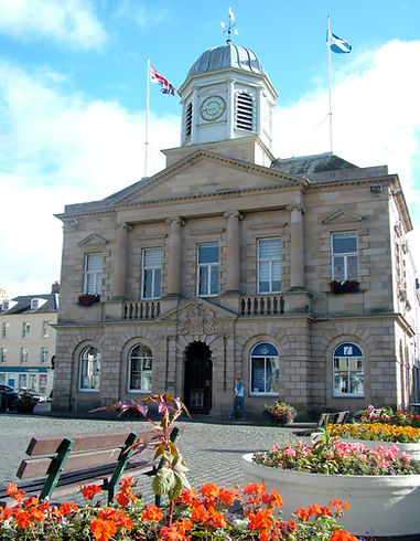
BORDERS BIKING
Few places in the UK have recognised that cycling is great for business - especially tourism - to the same extent as the Borders region, mind you, the fabulous scenery, welcoming towns and quiet roads give it a good start. Steve Dyster takes pleasure in revisiting old haunts.
And here's Steve's four day tour of the southern Scottish Borders, visiting some of the place in the text.

Sitting at the laptop, checking out my next tour in the Scottish Borders always seems to lead me to something new; cyclescottishborders.com always seems to have fresh content; images of the Tweedlove Festival celebrate another successful year and a nascent programme of events tempts one to book as much of June off work as possible and head for the sparkling streams, magnificent rivers, high moors and …. well all that jolly good cycling country.
Lucky folks from Edinburgh can access the Tweed by train (to Tweedbank, between Galashiels and Melrose), though sadly there is little prospect of the line being extended through Hawick all the way to Carlisle. Still, getting there by car is not difficult, nor is a ride-in, especially from Berwick-on-Tweed, although avoiding the A7, if approaching from Carlisle is paramount, in my opinion. In my experience, the A7 is the only truly busy - all things being relative - road in the region (OK, avoid the A1 in the east). Cycling east from Lockerbie is very pleasant, as is a departure from Carstairs - if you can get on a train that actually stops there. Carstairs is on the Clyde, but a quick nip over to Biggar brings you into the catchment of the Tweed.

The Borders has a short, but attractive stretch of coast, especially around the busy little port at Eyemouth. Generally the east, especially the Merse, is less rugged than the west, with more arable land and easier gradients, but even in the west, where the hills rise more steeply and the going is much more on the wild side, there’s good cycling for all ambitions. Consult the guides on the interactive map at cyclescottishborders.com or plan your own route. Top tip for the latter? Well, spend time looking at the contours, keeping height or adding a mile or two by taking a valley route pays dividends. Lovers of lumpiness , won’t care and will satisfy their passion with little difficulty when west of Melrose or north of Duns, whilst racking up the miles elsewhere.
A single day crossing from Berwick or Eyemouth makes for a challenging outing. Having bashed it out in order to take advantage of a cheap train fare from Carlisle, I’d recommend heading, one way or another, to Hawick and thence to Newcastleton and onward. The B6399 has great scenery to jolly cyclists up the long climb after Hawick. Railway fans will admire the viaducts along the course of the disused borders railway and might stop at the heritage centre at Whiterope Summit. Cyclists will then plunge down the road. The railway curved eastwards to Riccarton Junction, a truly remarkable community - once-upon-a-time. In its heyday, 118 people lived there, maintained and solely by rail. In 1963 a forest track gave the first road access. In 1969 the Waverley line through the borders was closed, following the line to Hexham and Newcastle’s earlier closure. That spelt the end of Riccarton village.

If you ignore the solemn ruins of Hermitage Castle, you may well stop next at Newcastleton (also known a Copshaw Law). Here is a village that has given itself a real boost by welcoming cyclists of all types. Nearby is the Newcastleton 7Stanes centre, whilst the Cross Border Trail is signed over to Kielder, Northumberland. In addition the longer Reiver’s Way runs through, on its way from Whitehaven to Tynemouth. Sticking almost solely within the Borders, however, is the superb Southern Borders Loop.
The Southern Borders Loop, not to be confused with he much longer Borders Loop, has a brief flirtation with Dumfries and Galloway, but is none the worse for that. Start anywhere along it. There are fifty and seventy-five mile options. Having ridden the latter, it is a challenging ride with five good long climbs, the nastiest or most exhilarating being that out of Langholm to Charlie’s Moss, on the way to Newcastleton. I began my day out in Hawick along the silent B711. This gem of a road, climbs over to the Alemoor Resrvoir. Amidst splendid moorland it joins the Rankle Burn at Buccleuch and funnels through a steep-sided valley to the isolated Tushielaw Inn.

Turning south, at first along the Etrrick Water and then the Tima Water, leads through a forest for a climb over to Eskdalemuir. Take time, if you like, to divert to the birthplace of border poet James Hogg, or meditate a little at the Samye-Ling Tibetan Centre or search out some of the antiquities that adorn the valley. You are also in Thomas Telford country, born here, some of his earliest work can be seen when completes the third climb and descent to Langholm - you’ll cross the bridge which he worked on.
It is possible to avoid the third climb by following the minor rtoad that sticks to the Esk valley, rather than cutting a corner. Lumpy in places, it passes several points of interest; on my last ride around here it was closed and my guide recommended sticking to the B709.

Langholm is great for lunch, tea, dinner, overnight stop, with more facilities than any settlement since leaving Hawick. This loop would make a fine, gentler, two day tour. Girding-up one’s loins, so to speak, the vigorous ascent to Charlie’s Moss requires no better excuse for a breather than the wonderful views as the road tops out. On the edge of the border hills, views of the Solway and the Lake District encourage a pause. There’s more up to follow, before the downhill race to the cafes and pubs of Newcastleton commences. From there, ’tis but a jaunt up to Whiterope Summit before freewheeling - a figure of speech - back to Hawick.
Of course, following other people’s routes does not always satisfy. A favourite of mine, and I claim no originality as I met several cyclists in the renowned Tibbie Shiels Inn - closed down, I believe, at the time of writing - who had followed versions, one way or another. Staying for a couple of days in Selkirk and fancying a lengthy day, the A707 - soon to become the A72 - took me out of town in Sunday morning traffic. That is, not very much. On a busier day, NCR1 runs roughly parallel on the south bank of the River Tweed - on lanes and tracks - for much of the way to Innerleithen and Peebles.
Traquair House is on NCR1 and further on is another of the 7Stanes centres, at Cardrona. NCR1 loops to the south after Peebles, whilst the A72 which can be busy, keeps to the river. There are proposals to build a cycle path along the old railway line that sticks to the Tweed. The section between Innerleithen and Peebles has been built, but beyond Peebles it remains under discussion. So, take your pick when leaving Peebles, or find your own way up to Manor Sware - a very fine viewpoint a little to the west of the town on the south side of the river and rejoin NCR1 later.
One way or another you will end up on the B712 and, at Rachan Mill, the A701. The Tweed is eventually left at Tweedsmuir, for a run up to and along the Talla Reservoir, followed by a sudden and, in my case quite shocking, ramp up to the Megget Stone at around 450 metres. In an area of much fine, remote cycling, this must be amongst the finest of roads.
Too soon the cyclist is deposited at Cappercleuch, on the banks of St. Mary’s Loch and the relatively major A708. This makes for an easy ride along the Yarrow Water to Selkirk. For those lucky or determined riders with plenty of energy, take a right at the Gordon Arms Hotel for a longer and hillier route or, for just a hillier route,a right turn at Yarrow. Both of the latter routes return to Selkirk along the valley of the Ettrick Water. Take your pick. Pop-pickers might ponder whether the Craig Douglas on the A708 was the one that the Singing Milkman’s manager saw before suggesting it was more showbiz than Terence Perkins. Others may just enjoy the scenery or take a peek at the birthplace of the explorer Mungo Park.


The eastern part of the Borders is lower and gentler, though do not underestimate it. There are plenty of undulations and some surprisingly long climbs. Heading eastward from Melrose, a good day can take in the The tri-topped Eildon Hills (though the best views are on the return), Scott’s view (the classic viewpoint of the Eildon Hills), historic Smailholm Tower and Kelso, with a return via Roxburgh and Ancrum or looping down to Hawick via Denholm. Hawick, though more industrialised than Selkirk or Melrose, makes for an interesting contrast and has made a very pleasant overnight stopping place on my rides around on several occasions.
Beyond Kelso, the country gets even gentler, though exploring the Cheviots from either Kelso or Jedburgh, will present a good variety of tougher routes full of old castles, old battlefields and plenty of lanes that end deep amongst the grassy hills.
The Merse, between the little town of Duns and Berwick-upon-Tweed, provides the easiest of Border cycling. The Tweed is the most spectacular sight, with pleasant views where the land rises, as it does at Coldstream. Where it is the remoteness of the Border hills and rivers that impress in the west; in the east it is the great houses, the farms and the oft ignored history, that get the attention. If you wish to be jolted out of this gentle cycling complacency, head north from Duns on a long loop to Dunbar, perhaps via White Castle and Nunraw Abbey. A double crossing of the Lammermuir Hills is not to be sniffed at.
But that would be getting off the current patch.

Information
Well, there is a lot of it. So try these for starters;
http://cyclescottishborders.com
http://www.visittweedvalley.co.uk/road-cycling
Though the Borders is well set up for cycling, areas of it remain remote. Be prepared to be independent. Most of the towns have bike shops, but be prepared to do basic roadside repairs; food and drink stops are there aplenty, but in places they may be a good old pedal apart; the weather is not as bad as the weather station at Tweedsmuir would have us believe (it is deliberately situated in a spot likely to attract rain), but be ready with sunscreen and waterproof.
Maps
OS 1:50 000 Sheets: 73, 74, 75, 79, 80 cover most of the territory mentioned, though there is some on 72, 67 and 85. If you are sticking to the roads, OS 1:250 000 Sheet 3 (Southern Scotland and Northumberland) is perfectly adequate for navigation, though not sufficiently detailed for deeper exploration. Sustrans pocket sized guides to the National Cycle Network sheets 34, 35, 38,39 cover the Borders and more, with information useful to cyclists and suggested day rides.
The routes I have mentioned are one’s I have enjoyed. I found some challenging - others may find them easier or harder. Those I covered in a day, others might wish to cover in two, or more. In many ways, I wish I had.

PUBLISHED DECEMBER 2016


